$14.95 
Scroll down for an
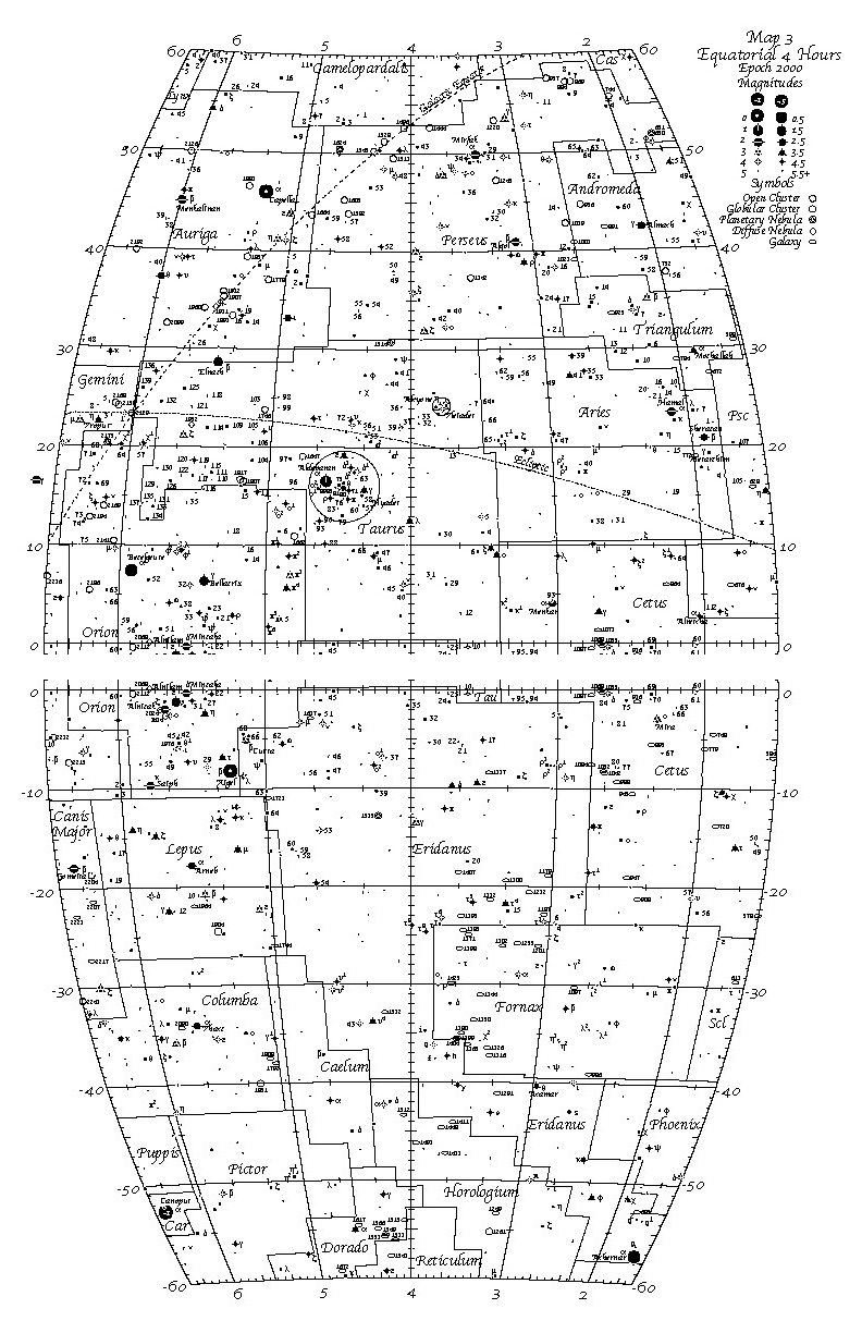
actual size Equatorial map
(72 dpi jpeg, not the
full 600 dpi quality of the real maps). The gap in the middle
is the fold line for the book.
|
Two Polar and six Equatorial
maps cover the sky in large enough swaths to make it easy to see relationships between
constellations, with minimum distortion. Each map is 11 x 17
inches printed on heavy duty card stock.
All stars down to 6th magnitude
plotted with easy
to read magnitude symbols.Lots of Non-Stellar objects
plotted -- I haven't
counted them but there's a whole bunch! Easy to follow directions
for picking the right map for the right time of night for the right time of year.Three tables of the best
and the brightest -- Table
of 32 Bright Stars, Table of 122 Multiple Stars, Table
of 160 Non Stellar Objects including all the Messier objects.
Large font makes them easy to read.Table of Constellation
names and abbreviations indexed to maps make it easy to find the right map.
No gratuitous use of color that make maps hard to read at night
and jacks up the price.
Use the money you
save to buy one of our Astronomer's flashlights!
Learn how to use a star atlas with one of our astronomy projects
|